Wednesday, April 27, 2011

Weather Conditions for Wednesday, April 27th 2011

Well these past couple of days have been a little bit cooler than normal it seems. I apologize for not updating my blog recently, but my computer's power source died and it tooke me a while to get a new one! All fixed now.

Currently it is 36 degrees F, with 100% cloud coverage. I would call them mainly stratus or nimbostratus. We did have a little bit of precipitation today, which seemed like a mixture of rain and sleet. The wind is coming in from the NW at 8mph. Weather.com is predicting rain/snow showers to develop overnight.

Graphic courtesy of The Weather Channel - http://www.weather.com/


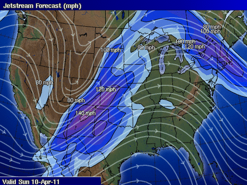
If we look at the current surface map we can see there isn't a whole lot of activity going on in our area. My prediction is that there won't be anymore showers throughout the night, just based on what we're seeing here. If we look toward the south we can see the large low pressure system that is causing such severe weather. Apparently at least 32 people are thought to have died in the deadly oubreak of tornadoes in Alabama and Mississippi. The system will continue to move to the East throughout the night. Hopefully it will calm down a little bit before it hits the Atlanta metro area (my family lives there!).

Tuesday, April 19, 2011

Weather Conditions for Tuesday, April 19th 2011


So there definitely was a system that moved through the state today, but nothing too bad happened here (thankfully!!). There were a couple snow flurries and raindrops around 4 or 5pm but nothing significant, and nothing that accumulated.


Graphic courtesy of UWEC Metstation

If we look at the barometric pressure readings from today, we see that right at 4:00 the pressure dropped dramatically, which indicates that this is when the low pressure system moved through. This is around the time when it started raining/snowing.

Currently the temperature is 33 deg F and the low for tonight is supposed to get to 31 deg. The wind is coming from the NE at 12 mph. There was mainly 100% cloud coverage today from what I could tell, and the majority of them were stratus, with some nimbostratus at times (around 4). 

Graphic courtesy of The Weather Channel - www.weather.com

If we look at the surface map, it looks like the majority of the major activity has moved to the East of us, with a few lingering flurries in our area. My predictions for tomorrow are going to be the same temperature-wise that it was today, with maybe a couple flurries or rain showers, but nothing that will accumulate.

Monday, April 18, 2011

Weather Conditions for Monday, April 18th 2011

So while the rest of the country gets tornadoes and thunderstorms, what are we supposed to get this week again? At the end of April? Yup, SNOW!

Apparently a Colorado low is developing and will result in 5-8 inches of snow for us.

Currently though, the temperature is 46 deg F. Wind is coming from the NNE at around 3 mph. It has been mostly cloudy all day with cirrostratus and cumulus clouds. The low for tonight is supposed to get to around 32 deg F.

Graphic courtesy of The Weather Channel - http://www.weather.com/


When we look at this surface map, we can see the low pressure systems forming in the Western states. This is what will be causing our lovely weather shift Tuesday night and into Wednesday. The predicted accumulation is around 5 to 8 inches. My prediction is similar to that of the National Weather Service, although I'm hoping the temperature will remain warm enough to where the majority of the precipitation we get isn't snow. I'd rather have slush, than snow! I'll be checking the barometric pressure readings off and on tomorrow to see the changes occur as the system approaches.

Sunday, April 10, 2011

Weather Conditions for Sunday, April 10th 2011

So last night we did end up having a couple of rumbles of thunder. Most of the larger storm cells were south of us. This evening we're supposed to get even stronger storms, and weather.com is predicting tornadoes in the area as well. Look at the Weather Channel's tornado predictions here.


Currently it is 67 degrees!! This is the highest it has been all Spring so far, so that is quite exciting. The high for today is 77 degrees, and the low tonight is supposed to get down to 43 degrees. The wind is SSE at 13mph.


Graphic courtesy of The Weather Channel - www.weather.com

If we look at this map we see a warm front over our area. This is the system that brought storms into our area last night, and you can now see they have made their way into Canada.

Graphic courtesy of The Weather Channel - www.weather.com

Here is the forecast for tonight, as you can see here we are in the red!

Graphic courtesy of Intellicast - www.intellicast.com

If we look at the jet stream, we're still in that trough, like we were last night. This is what is causing all these thunderstorms, and warm weather. The trough is bringing warm air up from the gulf. This pattern is what meteorologists have been predicting for that past couple of days.

So tonight we can expect strong to severe thunderstorms, possibly producing hail and even a chance of a tornado! So keep watching the skies!


Saturday, April 9, 2011

Weather Conditions for the week of 4/4/2011 and predictions for this weekend.

This week has been beautiful. Everyday since Monday has shown a warming trend, and it is finally getting into the lower 60's. There have been a couple cloudy days, but mainly zero to 5% cloud coverage with cirrostratus or simply cirrus clouds.

Today (Saturday) there is 100% cloud coverage with what look like simply stratus clouds at the moment. I have a feeling this weekend is going to get incredibly eventful for our area tonight and into tomorrow though, so it will be interesting to see how the clouds change from tonight into tomorrow. The temperature today is 52 degrees with a high of 63. The barometric pressure is at 29.86 Hg and it is falling slowly, which shows that a low pressure system is moving in.


Tonight NOAA is predicting severe thunderstorms in our area, but even more severe isolated storms in our area for tomorrow. 

Graphic courtesy of The Weather Channel - www.weather.com

If we look at the current surface map, we can see a low pressure system to the southwest, which is headed our way. This matches up with the current wind direction which is SSE at 8mph. I'll update again later in the day to look at how the surface map is changing and to see if my predictions are correct. What this basically means though, is that overnight and all day tomorrow we are in for a lot of strong thunderstorms, with a possibility of strong winds, hail, and even tornadoes.

Wednesday, March 30, 2011

Weather Conditions for Wednesday, March 30th 2011

The weather this week has been abnormal for late March weather. The temperatures are much lower than usual. It tends to warm up slightly during the day, but it's still cooler than usual. The low for today is 25 (for tonight), and it is currently 39 degrees out. The wind is coming in from the NW, at around 3 mph. There wasn't a lot of cloud coverage from what I could see this morning, except for a few cirrus clouds.

Graphic courtesy of The Weather Channel - http://www.weather.com/


If you look at the current weather map, there are a lot of strange things going on. There are two low pressure systems, right near two high pressure systems in the central part of the country. Along with the two cold fronts in the south eastern states. As you can see, there really isn't a lot going on in our part of the country at the moment.

One good thing about this weather is that the cooler temperatures at night and the slightly warmer temps during the day are slowing down the melting snow. It is taking a lot longer for the snow to melt, which is better for our area flood-wise. There probably won't be as severe of a flood that they were predicting before because of this.


Tuesday, March 22, 2011

Crazy weather in Appleton, WI

Right now I'm on Spring Break, so I'm not in Eau Claire, I'm in my hometown of Appleton, WI. I just felt the need to post about the weirdest weather I've ever seen in my life (I'm sure this happens a lot in the spring, I'm just not used to it). This morning in Appleton we had snow, which then turned to rain, and then turned to sleet. At one point it felt like it was doing all three at the same time.

It has been sleeting now in Appleton for about 8 hours, and there is quite an accumulation of sleet on the ground. The sleet has been mixed with thunderstorms, so it has been sleeting and thundering and lightning for quite a while now.

Graphic courtesy of The Weather Channel - http://www.weather.com/

If we look at the current weather map we can see a low pressure system as well as a warm front that may be causing this weather. The higher temperatures in the lower part of the state are causing the precipitation to be rain, and in the northern part of the state the precipitation is snow due to the lower temperatures. In between we have the sleet, which is where Appleton lies at the moment.

Graphic courtesy of The Weather Channel - http://www.weather.com/


Another interesting thing to look at is the amount of lightning strikes in the area. A lot of these lightning strikes are occurring in the middle of blizzard-like conditions. There have been quite a few strikes in the past couple hours here in Appleton, and they are all very bright, loud, cloud-to-ground lighting strikes. So this is definitely weird weather, that I felt seemed "blog-worthy".