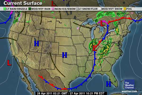
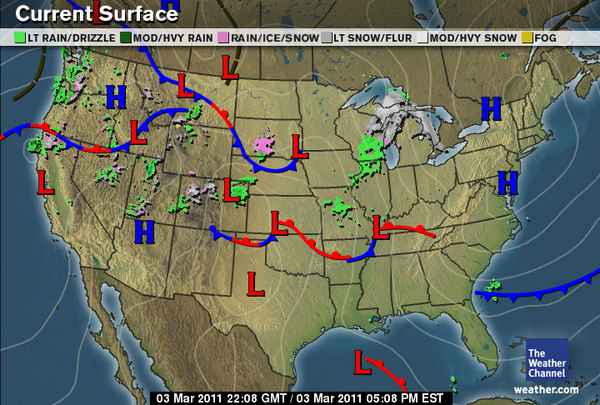
Graphic courtesy of The Weather Channel - www.weather.com
(Again, if you haven't seen my note below, the links I have been using for these images are live URLs from Weather.com and Intellicast, and whenever they are updated on those websites, they are also updated on here. So if you are looking at these images at a later date, they may not go with the descriptions I have for them.)
Looking at the current surface map we can see there isn't a whole lot going on in our area. There are a couple high pressure systems in the middle states which is giving us such beautiful weather. As long as these high pressure domes are in the area, I suspect that the weather will continue on like this for the next couple of days.