Wednesday, April 27, 2011

Data Analysis of January, February, March and April to date.

So far it seems like it has been a crazy year weather-wise. Here are the past four months summed up.


Temperature


In January we definitely see a lot of cooler temperatures, and a sharp drop in temperatures toward the end of the month. The temperatures fluctuate quite a bit.


In February we see a lot of fluctuation of temperatures, a little bit more than in January. There is a larger drop in temperature towards the beginning of the month, and then some higher temperatures, in the 50’s, in the middle of the month.


In March the fluctuation in temperature seems a bit more dramatic. There are some really low temperatures in the beginning of the month and then some high temperatures in the middle of the month. The temperatures at the end of the month are forming a rising trend and we move into April.


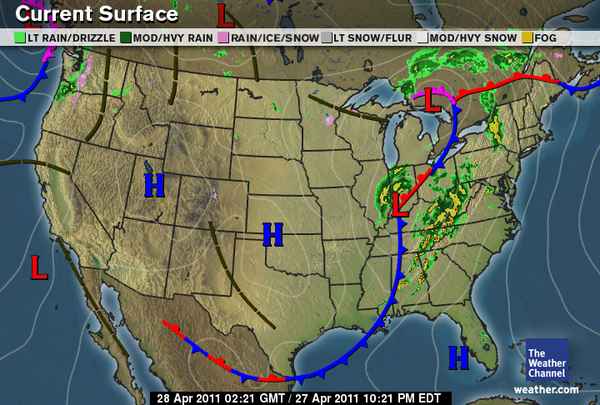
In April the temperatures haven’t fluctuated as much as past months, but there are still some changes. There is a period of really high temperatures, and then a longer period of time with some cooler temperatures. The large spike in temperature around April 10th is I believe the same time we had Severe Weather in our area.


Precipitation/Rainfall

Since the Metstation here on campus only measures precipitation in amount of Rainfall, there is no data available for January, since it did not rain because of such low temperatures!


In February there was one day where there was rainfall. If we look at both temperature and rainfall, we can see that the temperature was higher, or rising when the rainfall occurred.


When we look at rainfall in March, we see that there is a larger amount of rain, which is because of the higher temperatures. The majority of the rainfall that occurred, happened on days with warmer average temperatures.


April rainfall has significantly increased compared to March, February and January. The temperatures are higher for the most part, and instead of snowfall we are receiving rain as precipitation.


Wind Direction


The prevailing wind direction in January was West, followed by North West and West South West.


In February the prevailing wind direction was also West, like January. On the one day that there was rainfall, the wind was coming from the South East.


In March West is still a prevailing wind direction, but East is just as prevalent. With each month West is occurring less.


In April the West wind directions have slowed down quite a bit, and the leading Wind direction is East. This could be because of the increasing amount of low pressure systems that have moving across the country from the West, causing a lot of strange weather.

Summary

There are a number of trends that are prevalent in all of these graphs. With the temperature graphs, it is obvious that the temperature is rising with each month, albeit very slowly. When looking at the rainfall graphs, it is obvious that there is more and more rain with each month, due to the warmer temperatures. When comparing the wind direction graphs, there are less days with wind coming from the West with every month, and more days with wind coming from the East. There are a few anomalies that stick out, for example in the January graph there are a couple days where the temperature is extremely low compared to the rest of the days in the month. In February one week shows cold temperatures, and then the next week has the highest temperatures so far at that point. In the beginning of March there was an extremely cold day and then temperatures went back to 30’s, 40’s and 50’s shortly afterwards. In April on anomaly is around the 10th or 11th when temperatures reached the highest so far. This was when there was a lot of severe weather moving through our area due to a large trough in the jet stream. There were many tornadoes all over the state as a result of this.

Climograph

When we compare this data to a climograph of past months in Eau Claire, we see that the overall average temperatures have been normal, with a few anomalies here and there. There definitely hasn’t been as much rainfall, but that could be because of the snow and sleet we have gotten instead of rain this month and last month.


The average maximum temperature for April is only a little low (52 deg F, compared to 56-57), after having a couple days of temperatures in the 30’s and 40’s it seems as if it should be lower than that. We did have a couple days with high temperatures thrown in the mix as well though, which would raise the average a bit. Even though the weather we’ve been having recently has seemed strange, the data here shows that the temperatures are in the normal range. 


All graphs were created by me and belong to me. So don't steal them. Unless you're Professor Hupy.

Weather Conditions for Wednesday, April 27th 2011

Well these past couple of days have been a little bit cooler than normal it seems. I apologize for not updating my blog recently, but my computer's power source died and it tooke me a while to get a new one! All fixed now.

Currently it is 36 degrees F, with 100% cloud coverage. I would call them mainly stratus or nimbostratus. We did have a little bit of precipitation today, which seemed like a mixture of rain and sleet. The wind is coming in from the NW at 8mph. Weather.com is predicting rain/snow showers to develop overnight.

Graphic courtesy of The Weather Channel - http://www.weather.com/


If we look at the current surface map we can see there isn't a whole lot of activity going on in our area. My prediction is that there won't be anymore showers throughout the night, just based on what we're seeing here. If we look toward the south we can see the large low pressure system that is causing such severe weather. Apparently at least 32 people are thought to have died in the deadly oubreak of tornadoes in Alabama and Mississippi. The system will continue to move to the East throughout the night. Hopefully it will calm down a little bit before it hits the Atlanta metro area (my family lives there!).

Tuesday, April 19, 2011

Weather Conditions for Tuesday, April 19th 2011


So there definitely was a system that moved through the state today, but nothing too bad happened here (thankfully!!). There were a couple snow flurries and raindrops around 4 or 5pm but nothing significant, and nothing that accumulated.


Graphic courtesy of UWEC Metstation

If we look at the barometric pressure readings from today, we see that right at 4:00 the pressure dropped dramatically, which indicates that this is when the low pressure system moved through. This is around the time when it started raining/snowing.

Currently the temperature is 33 deg F and the low for tonight is supposed to get to 31 deg. The wind is coming from the NE at 12 mph. There was mainly 100% cloud coverage today from what I could tell, and the majority of them were stratus, with some nimbostratus at times (around 4). 

Graphic courtesy of The Weather Channel - www.weather.com

If we look at the surface map, it looks like the majority of the major activity has moved to the East of us, with a few lingering flurries in our area. My predictions for tomorrow are going to be the same temperature-wise that it was today, with maybe a couple flurries or rain showers, but nothing that will accumulate.

Monday, April 18, 2011

Weather Conditions for Monday, April 18th 2011

So while the rest of the country gets tornadoes and thunderstorms, what are we supposed to get this week again? At the end of April? Yup, SNOW!

Apparently a Colorado low is developing and will result in 5-8 inches of snow for us.

Currently though, the temperature is 46 deg F. Wind is coming from the NNE at around 3 mph. It has been mostly cloudy all day with cirrostratus and cumulus clouds. The low for tonight is supposed to get to around 32 deg F.

Graphic courtesy of The Weather Channel - http://www.weather.com/


When we look at this surface map, we can see the low pressure systems forming in the Western states. This is what will be causing our lovely weather shift Tuesday night and into Wednesday. The predicted accumulation is around 5 to 8 inches. My prediction is similar to that of the National Weather Service, although I'm hoping the temperature will remain warm enough to where the majority of the precipitation we get isn't snow. I'd rather have slush, than snow! I'll be checking the barometric pressure readings off and on tomorrow to see the changes occur as the system approaches.

Sunday, April 10, 2011

Weather Conditions for Sunday, April 10th 2011

So last night we did end up having a couple of rumbles of thunder. Most of the larger storm cells were south of us. This evening we're supposed to get even stronger storms, and weather.com is predicting tornadoes in the area as well. Look at the Weather Channel's tornado predictions here.


Currently it is 67 degrees!! This is the highest it has been all Spring so far, so that is quite exciting. The high for today is 77 degrees, and the low tonight is supposed to get down to 43 degrees. The wind is SSE at 13mph.


Graphic courtesy of The Weather Channel - www.weather.com

If we look at this map we see a warm front over our area. This is the system that brought storms into our area last night, and you can now see they have made their way into Canada.

Graphic courtesy of The Weather Channel - www.weather.com

Here is the forecast for tonight, as you can see here we are in the red!

Graphic courtesy of Intellicast - www.intellicast.com

If we look at the jet stream, we're still in that trough, like we were last night. This is what is causing all these thunderstorms, and warm weather. The trough is bringing warm air up from the gulf. This pattern is what meteorologists have been predicting for that past couple of days.

So tonight we can expect strong to severe thunderstorms, possibly producing hail and even a chance of a tornado! So keep watching the skies!


Saturday, April 9, 2011

Weather Conditions for the week of 4/4/2011 and predictions for this weekend.

This week has been beautiful. Everyday since Monday has shown a warming trend, and it is finally getting into the lower 60's. There have been a couple cloudy days, but mainly zero to 5% cloud coverage with cirrostratus or simply cirrus clouds.

Today (Saturday) there is 100% cloud coverage with what look like simply stratus clouds at the moment. I have a feeling this weekend is going to get incredibly eventful for our area tonight and into tomorrow though, so it will be interesting to see how the clouds change from tonight into tomorrow. The temperature today is 52 degrees with a high of 63. The barometric pressure is at 29.86 Hg and it is falling slowly, which shows that a low pressure system is moving in.


Tonight NOAA is predicting severe thunderstorms in our area, but even more severe isolated storms in our area for tomorrow. 

Graphic courtesy of The Weather Channel - www.weather.com

If we look at the current surface map, we can see a low pressure system to the southwest, which is headed our way. This matches up with the current wind direction which is SSE at 8mph. I'll update again later in the day to look at how the surface map is changing and to see if my predictions are correct. What this basically means though, is that overnight and all day tomorrow we are in for a lot of strong thunderstorms, with a possibility of strong winds, hail, and even tornadoes.