Currently it is 67 degrees!! This is the highest it has been all Spring so far, so that is quite exciting. The high for today is 77 degrees, and the low tonight is supposed to get down to 43 degrees. The wind is SSE at 13mph.

Graphic courtesy of The Weather Channel - www.weather.com
If we look at this map we see a warm front over our area. This is the system that brought storms into our area last night, and you can now see they have made their way into Canada.

Graphic courtesy of The Weather Channel - www.weather.com
Here is the forecast for tonight, as you can see here we are in the red!
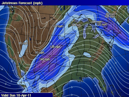
Graphic courtesy of Intellicast - www.intellicast.com
If we look at the jet stream, we're still in that trough, like we were last night. This is what is causing all these thunderstorms, and warm weather. The trough is bringing warm air up from the gulf. This pattern is what meteorologists have been predicting for that past couple of days.
So tonight we can expect strong to severe thunderstorms, possibly producing hail and even a chance of a tornado! So keep watching the skies!
No comments:
Post a Comment